2024 | Buch

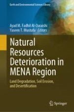
Natural Resources Deterioration in MENA Region

Land Degradation, Soil Erosion, and Desertification

insite
SUCHEN

Über dieses Buch

Land deterioration, drought, desertification, and water resources shrinkage threaten natural resources, negatively impacting environmental, economic, and political stability. The increasing occurrence of climate change (extremes) impacts land degradation processes, soil erosion by water and wind, and salinization. The researchers have invested several years of scientific research in natural resources deterioration, including soil degradation and erosion, land degradation, desertification, and climate changes, which are interesting enough. However, the link between science and policymaking appears to be less active as serious actions do not take fast. The eighteen chapters of this book focus more on topics related to natural resources deterioration, such as land degradation, desertification, drought, climate change, and analysis of numerous case studies.

This book presents experts' overviews, study results, experiences, and knowledge of natural resources deterioration in MENA countries. It attracts researchers, experts, scholars, scientists, academics, students, practitioners, graduates, or anybody interested in land degradation, desertification, climate change, and natural hazards that fall within natural resources deterioration. Therefore, researchers keep continuing to do their investigations and produce results that convince stakeholders and policymaking to act immediately towards protecting natural resources and their sustainability.
Inhaltsverzeichnis

Frontmatter

Land Degradation—Geological and Hydrological Status

Frontmatter
Remote Sensing Techniques for Investigating Natural Resources Deterioration: Application on Agricultural Degradation in Sultanate Oman
Abstract
Agriculture is an important economic sector that provides food and other resources for the global population. However, various environmental and climatic issues, such as declining arable areas, erosion, climate change, water scarcity, drought, cyclones, crop and livestock pests, disease and infection, and soil salinity, pose growing challenges to agricultural sustainability. These difficulties can lead to agricultural land degradation, affecting crop productivity and food security considerably. Remote sensing techniques involve the use of satellite or aerial pictures to analyze and monitor the status of agricultural land. These strategies can be used to identify and quantify agricultural degradation indicators, such as soil erosion, crop stress, and insect infestations. One of the most important advantages of remote sensing in this application is its capacity to cover enormous expanses of land rapidly and effectively without requiring ground-based measurements. This enables a more frequent and thorough investigation of agricultural conditions, which may be used to influence management decisions and to prevent the negative consequences of degradation. These strategies can provide valuable insights into the health and productivity of agricultural fields and assist in identifying areas that may require further improvement.
Yaseen A. Al-Mulla, Ahsan Ali, Mezna Alalawi, Mohammed Bait-Suwailam
Spectral Angle Mapper Approach (SAM) for Land Degradation Mapping: A Case Study of the Oued Lahdar Watershed in the Pre-Rif Region (Morocco)
Abstract
Land degradation is a complex and widespread environmental issue with significant implications for global sustainability. It encompasses various processes that negatively impact soil health and support productive ecosystems and human livelihoods. This chapter focused on mapping land use/land cover (LULC) and identifying land degradation features using Sentinel-2 imagery and the Spectral Angle Mapper (SAM) approach. The primary objective was to gain insight into the spatial distribution of land degradation within the study area. The step-by-step supervised classification process involved data preparation, training data collection, feature selection, SAM classification, and post-classification processing. An accuracy assessment was conducted to validate the results and ensure the reliability of the land cover map. As a result of the different LULC classifications in the research area, the arboriculture class represented 18% of the study area. In contrast, the agriculture class showed coverage of 27%, followed by the forest class occupying 22% of the catchment area, and the bare soil class representing 33% of the total study area. The combination of substantial proportions of bare soil (33%) and agriculture (27%) suggested that a large portion of the landscape may be susceptible to land degradation if appropriate measures are not implemented. The derived LULC map is a valuable resource for environmental monitoring, ecosystem conservation, and land use planning. Policymakers, researchers, and stakeholders can use this information to make informed decisions for sustainable land management, protect natural resources, and mitigate the impact of land degradation.
Brahim Benzougagh, Ayad M. Fadhil Al-Quraishi, Youssef Bammou, Shuraik Kader, Mohammed El Brahimi, Driss Sadkaoui, Latifa Ladel
Remotely Sensed Data and GIS for Long-Term Monitoring of the Ghout Oases Degradation in the Region of Oued Souf (Northeastern Algerian Sahara)
Abstract
For 12 centuries, Ghout oases in the region of Oued Souf constituted an efficient and sustainable agro-system, based on optimal adaptation to the specific local environment and limited socioeconomic needs. This study aims to spatiotemporally assess and monitor the Ghout oases dynamics in 18 municipalities in the El Oued governorate, using medium-resolution imagery of Landsat and GIS from 1987 to 2018, based on spectral indices and change detection method. The obtained results confirm the official statistics and highlight the considerable decrease in the Ghout-occupied areas from 4,462 ha (1987) to 1,033 ha (2018), especially in the northern areas, as well as increasing of the built-up superficies and extension of new irrigated perimeters throughout the entire region. The recent mutation from a traditional Oasian system based on durability and self-sufficiency into an evolved system controlled by a free economy mechanism engendered the imbalance of Oasian ecosystem functioning, which manifests in groundwater level fluctuation leading, principally, to the disappearance of the Ghout oases. For sustainable and effective Saharan agro-development, it is necessary to adopt appropriate economic strategies based on the rational and controlled exploitation of the soil and water resources.
Nouar Boulghobra
Tectonic and Erosion in the Zagros Fold-and-Thrust Belt (ZFTB)
Abstract
Denudation involves weathering mountains and soil formation over long periods and is classified as soil degradation. This study focuses on the relationship between uplift and denudation using the hypsometric index (HI) and river profile steepness as key points to describe erosional processes and their relationship with environmental land degradation in the Zagros Fold and Thrust Belt (ZFTB). The interplay between tectonics, climate, and geomorphological features has been investigated to shed light on the erosional processes in the ZFTB. There is uniformity between regions of higher precipitation, steep slopes, higher river steepness, and higher HI, particularly, in areas to the northeast of the Kirkuk Embayment (KE) and areas of Bakhtyari Culmination (BCu). Higher-strength lithologies show consistency with the areas of higher HI, steepness, and higher precipitation, implying that the erodibility of exposed lithology does not control higher geomorphic indices values. The results showed a coupling between climate (e.g., orographic rain) and tectonic uplift controlling higher erosion areas (land degradation), where we found steep slopes, high HI, and steepness values.
Ahmed K. Obaid, Arsalan A. Othman, Sarkawt G. Salar, Varoujan K. Sissakian, Salahalddin S. Ali
Characterization of Post-uprising Impacts on Landcover and Land Use: Al Wasita-Satish—Area Northeast Libya Case Study
Abstract
Spatial and temporal processes primarily drive land use and land cover (LULC) changes through human activities, such as agricultural expansion and demographic change. This study aims to quantify the LULC change resulting from the civil war in Al Wasita-Satish Plateau, NE Libya. Using two satellite images from the Landsat 5 Thematic Mapper (TM) in 2010 and Landsat 8 OLI-TIRs in 2022, LULC changes were evaluated. Agriculture and arid, urban, dense, and sparse vegetation were the predominant LULC types in the study area. In 2010, sparse vegetation comprised the most significant percentage of the land area (37.15%), followed by dense vegetation (26.45%), agriculture (18.69%), and barren land. The constructed category had a relatively small area (1, 31%). According to the LULC maps for 2022, the proportion of barren land increased by 30.50% and sparse vegetation decreased by 29.09% and dense vegetation decreased by 15.81%. In addition, there was a slight increase in the agricultural (18.69%) and urban classes (4.25%). The findings demonstrate that the Libyan Civil War of 2011 affected the LULC, where land and environmental protection laws and law enforcement tools were rendered ineffective. Despite the absence of armed conflict in the study area, the displacement of people from conflict zones and their settlements contributed to the change in LULC. Local communities that practice agriculture and grazing have created alternative economic activities with a quick and comfortable financial return, such as the construction of tourist settlements, due to the area's popularity as a tourist destination and lack of financial resources.
Salah Hamad, Attia Alsanousi
Construction Industry Role in Natural Resources Depletion and How to Reduce It
Abstract
Due to the limited natural resources on our planet, we must take into account three essential factors, including environment, society, and economy, in all design and construction aspects. The environment has suffered because of the devastating human impact on our planet caused by industries that pollute, destroy, and produce waste. Rising levels of carbon dioxide and other greenhouse gases (GHG) have contributed to global warming, which has caused climate change that affects human life and threatens the coming generations. Among industries, construction has an aggressive impact on the environment. This is responsible for the detrimental consumption of raw materials from Earth. It is responsible for extracting a large amount of natural resources worldwide. The construction sector contributes to air pollution, climatic change, water pollution, and landfill waste. It is responsible for high energy use and carbon dioxide emissions. This study views the construction industry’s effects on the environment, energy spending, and natural resource depletion to lighten the impact the construction industry has on the environment and how to reduce it. This chapter considers the construction industry’s impact on natural resources and ways to control and mitigate this impact. The chapter tracks several trends in the construction industry: sustainable design is becoming increasingly mainstream and growing to seek appropriate ways to conserve natural resources and protect the environment. Construction materials continue to evolve with higher-strength steel and concrete, high-performance glazing, waste reduction, and material recycling.
Bayan Salim Obaid Al-Numan

Soil Erosion

Frontmatter
Assessing Soil Erosion Vulnerability in Semi-Arid Haouz Plain, Marrakech, Morocco: Land Cover, Socio-Spatial Mutations, and Climatic Variations
Abstract
The most serious type of land degradation is soil water erosion, which negatively affects agricultural production and has important environmental and socio-economic implications. Human activity promotes soil water erosion. Although much research has been conducted on this subject, there are few studies on soil erosion, especially in the study area. The spatiotemporal variation of soil erosion from 1992, 2002, and 2020 was studied using the spatial model of soil erosion risk and mapping the annual rate of soil loss in the Haouz plain in the lower part of the Tensift Basin in Morocco. The Revised Universal Soil Loss Equation (RUSLE) model, analyzed in a Geographic Information System (GIS), was adopted to estimate soil loss. This study aimed to identify the characteristics and variations in soil erosion under the combined effects of climate factors and land use change. The soil erosion rate of the study area experienced erosion at different levels and is estimated to be 9.84, 13.76, and 14.32% in 1992, 2002, and 2020, respectively. Precipitation, soil, land use, and digital terrain model data were used to construct individual model variables. The GIS platform processes and multiplies the raster layers of topography, cover management, soil erodibility, rainfall erosivity, and conservation techniques. At sites with steep slopes and degraded slopes, the predicted soil loss ranged from 0 to 35 t/ha/yr. Based on the spatial distribution of soil erosion risk, 2.90, 7.74, and 19.01% of the plains experienced soil losses greater than 26t/ha/yr in 1992, 2002, and 2020, respectively. The results indicated strong soil erosion. To effectively plan and execute sustainable soil management methods to prevent soil erosion, especially for the sustainability of the plain, an accurate estimate of soil loss was provided by the RUSLE and GIS methodology.
Youssef Bammou, Brahim Benzougagh, Brahim Igmoullan, Ayad M. Fadhil Al-Quraishi, Fadhil Ali Ghaib, Shuraik Kader
GIS-Based Erosion Potential Method (EPM) for Soil Degradation Evaluation: A Case Study the Northeast of Morocco
Abstract
Soil degradation is a significant environmental concern, posing severe challenges to sustainable agriculture and land management. The Northeast region of Morocco is particularly susceptible to soil erosion, owing to a combination of factors, including topography, geomorphology, geology, climate, and land use practices. This chapter introduces a GIS-based Erosion Potential Method (EPM) designed to assess soil degradation in the Oued Amter watershed in Northeast Morocco. This study developed a comprehensive erosion risk assessment model by integrating various spatial data, such as topography, rainfall, land cover, and soil properties. The results of this study reveal that soil loss varies significantly, ranging from 55.91 to 44,088.33 m3/km2/year across the Oued Amter watershed. These findings underscore the urgent need to address the region's soil conservation and land use planning. Policymakers, land managers, and researchers can use EPM outcomes to make informed decisions and implement effective measures to safeguard the soil and promote sustainable land use practices.
Mohammed El Brahimi, Brahim Benzougagh, Mohamed Mastere, Bouchta El Fellah, Ayad M. Fadhil Al-Quraishi, Najia Fartas, Khaled Mohamed Khedhe
Predicting Soil Erosion Using RUSLE Model in Duhok Governorate, Kurdistan Region of Iraq
Abstract
Soil erosion is a main cause of land degradation, adveresly impacting soil health, soil fertility, and soil carbon. This study used the revised universal soil loss equation (RUSLE) model and geoinformatics tools to predict soil erosion rates in the Duhok governorate, located in the Kurdistan Region of Iraq (KRI). The RUSLE model integrates several to predict annual soil loss: soil erodibility factor (K), rainfall erosivity factor (R), slope (L), slope steepness factor (S), land use/cover factor (C), and conservation methods (P). Information layers for these variables were created using ArcGIS 10.3, showing the extent of soil erosion. Additionally, we identified and prioritized erosion hotspots to implement conservation practices. The results showed that approximately 78% of the study area experienced very low and low levels of soil erosion, whereas only 4 and 7% were subject to high and very high erosion rates, respectively. The findings also emphasized the significance of slope and land-use interactions in accelerating soil erosion, particularly in agricultural areas characterized by steep slopes.
Azade Mehri, Hazhir Karimi, Yaseen T. Mustafa, Ayad M. Fadhil Al-Quraishi, Saman Galalizadeh

Drifting Sands, Sand/Dust Storms, and Desertification

Frontmatter
Spatiotemporal Variability of Aerosol Optical Depth Over the Arabian Peninsula Using MODIS Data
Abstract
The Arabian Peninsula, located at the western end of the Asian continent, is one of the driest places on Earth, similar to the Sahara Desert in northern Africa. It is predominantly composed of two large extended desert regions, the Empty Quarter and Nufud Desert, which combine to create one of the largest desert regions in the world. The Arabian Peninsula, owing to its massive size and abundance of sand and dust, is considered one of the major atmospheric dust sources in the world. The atmospheric dust emitted by the deserts of this region is transported locally, regionally, and globally by wind. The transported dust significantly contributed to the overall aerosol optical depth (AOD) and region of the area. In-depth studies related to the temporal and spatial variability of dust transport are of great importance because of its adverse effects on human health, climate, ocean conditions, and marine life. In this study, multi-temporal AOD products from the Moderate Resolution Imaging Spectroradiometer (MODIS) were effectively used to identify the seasonal and inter-annual variability and spatial distribution of AOD over the study area. The preliminary findings of the AOD data analysis show that the desert surface of the empty quarter consistently shows high AOD levels along with coastal areas in the region during summer. In contrast, mountainous areas south of Yemen, northeast of Oman, and northwest of Saudi Arabia show the lowest AOD levels due to the absence of significant sand and dust particles. Furthermore, the analysis shows distinctive monthly, seasonal, and annual variability that is strongly linked to the local climatology of the area. It was found that the spring and summer AOD were usually the highest owing to the intensive wind pattern, increased dust emissions, and high humidity. The inter-annual variability of AOD over the study area was not significantly different, mostly related to sporadic dust storm events occurring in particular years. The annual AOD concentration levels increased at a rate of 0.5% annually during the study period 2003–2019.
Abdelgadir Abuelgasim, Ashraf Farahat
The Carrying Loads Composition of Storms Over Iraq
Abstract
One of the worst environmental issues in the Middle East is the occurrence of sand and dust storms. This study examines the amount of load in Iraq's dust storms over four years, from 2007 to 2010. This study aimed to develop a monitoring methodology and investigate SDS's inorganic and organic compositions of the present work covering central and southern Iraq. Samples from the settled dust were collected and analyzed using well-known analytical procedures. The results revealed that the average texture was sandy silty clay; the light minerals were mainly quartz and carbonate with feldspar and gypsum, as well as clay and heavy minerals. Heavy metals, such as Fe, Pb, Zn, Ni, Co, Cd, and Cu. The average uranium activity was lower than the critical dose level. The existing pollens are Pine, Chenopodiaceae, Palmae, Graminea, Olea, Typha, and Artemisia, with some Algae, Fungi, Cuticle, and spores. Fungi and bacteria, such as the gram-positive bacilli, E. coli, and the fungal Aspergillus species, are also common. Viral etiology analysis did not reveal any viral isolates. Aerosols in Iraq are a mixture of naturally occurring and anthropogenic pollutants, and basic information about their composition is vital for the Environmental Risk Assessment of dust in Iraq.
Moutaz A. Al-Dabbas
Monitoring Drifting Sand Using Spectral Index and Landsat TM/OLI Datasets in Bahr An-Najaf Area, Iraq
Abstract
This chapter analyzed the spatial and temporal characteristics of sand dunes, focusing on the rates of creep and movement of both dunes and sand. The study area comprised four types of sand features: Barchan dunes, Longitudinal dunes, Nabkha, and Sand sheets. Hazard analysis of the sand dunes was conducted using a combination of remote sensing techniques and field observations. Four Landsat TM/OLI images (22 Aug. 1988, 18 Aug. 1998, 13 Aug. 2008, and 9 Aug. 2018) have been used to achieve the objectives. The study area utilized the Normalized Difference Sand Dunes Index (NDSDI) to identify and map drifting sand. Notably, the size of the sand dunes underwent significant changes between 1988 and 2008 but remained relatively stable from 1978 to 1988. During these periods, the sand dunes expanded in area, but the valleys in the research region impeded their progress. This expansion and migration of sand dunes substantially threaten human activities in Al-Rahima, Eitha, Khiribah, and Um-Tharawi, with the risk increasing over time. Every decade, the encroachment rate of these sand dunes has been calculated, and it has been found that they approach areas and communities within a distance of 3000 m, indicating the proximity of the hazard. Among the dune fields, the third field demonstrated the fastest creep rate. Overall, the risk posed by these sand dunes has intensified, leading inhabitants in specific regions (southwest of Al-Rahima and Al-Ruhba) to abandon their houses and farmlands. Furthermore, industrial activities, including public services such as utility poles and roadways, are also affected.
Ghadeer F. Al-Kasoob, Ahmed H. Al-Sulttani, Ayad M. Fadhil Al-Quraishi, Ragad N. Hussein
Assessment of the Growth of Urban Heat Island in a Mediterranean Environment: A Pathway Toward a Sustainable City
Abstract
Rapid urbanization can induce significant changes in the urban climate. It is a great threat to the urban environment and human life quality. Therefore, sustainable urban development needs to find a balance between urban expansion and the thermal environment. This chapter proposes a methodology for monitoring and quantifying the growth of urban heat island (UHI) in response to land-use land-cover (LULC) change impacts based on a time series of Landsat remote sensing-based images and geospatial tools. The work was conducted in the city of Meknes, located in the central part of Morocco, as a case study. First, Land Surface Temperature (LST) was calculated from 1990 to 2020 using the thermal bands of Landsat images. Second, LULC and several vegetation indices were assessed, and the MOD11A1 MODIS product was used to develop the LST time series from 2000 to 2021 using the Google Earth engine platform. The results showed that the maximum LST in Meknes has increased by almost 10 °C during the past decades, and an overlay of the land surface temperatures with several land cover indicators shows that the increase in land surface temperatures is clearly correlated with the conversion of vegetation cover to built-up areas. The analysis of land use land cover changes (LULCC) showed an increase for the urban area and the arboriculture of about 12.6 and 6.07 km2, respectively, in the same period, whereas the cereals and peri-urban areas were reduced by 16.18 and 2.52 km2 respectively.
Mohammed El Hafyani, Narjisse Essahlaoui, Ali Essahlaoui, Meriame Mohajane, Abdelali Khrabcha, Anton Van Rompaey
Environmental Challenges, The Impacts of Climate Change in North Africa Region: A Review
Abstract
Global climate change effects, referred to as “environmental stresses,” in North Africa (NA) may be anthropocentrically caused or naturally occurring. This region is one of the regions most sensitive to climate change because of its location and dry environment. Even though nations in the NA area have distinct political and social frameworks, access to natural resources, and wealth levels, the region is bound by major environmental issues and international disputes. This chapter examines the regional impacts of global climate change in North Africa by focusing on the most pressing environmental issues and potential remedies. This chapter clarifies that climate change is mostly to blame the environmental problems in the North African region, which threatens the long-term stability of the area, particularly in terms of poverty, inequality, and underdevelopment. However, attempts to address these issues have been hampered by genuine ignorance of their causes and potential solutions. As one of the most water-scarce regions in the world with a heavy reliance on climate-sensitive agriculture, North Africa’s economic and social situation will likely worsen in the future. Mitigating climate change will remove resources from initiatives to combat poverty, unemployment, and subpar living circumstances, endangering the viability of the development process. North African nations must consider environmental conservation in the context of regional sustainable development and propose responsibilities that the government and outside aid should take.
Afeez Alabi Salami, Olushola Razak Babatunde
Soil Salinization Impacts on Land Degradation and Desertification Phenomenon in An-Najaf Governorate, Iraq
Abstract
The danger of Desertification is one of the most important global problems facing large areas of the world, the affected ones by the extreme conditions of aridity that maliciously change all environmental, economic and social levels. The problem has been greatly exacerbated in Iraq after 1992, for many reasons including: climate change, low rates of rainfall, and urbanization at the expense of agricultural land without regard to rules and regulations, unsustainable farming practices and poor irrigation. The increasing decline in surface water levels of Iraq's rivers has been further aggravated by this phenomenon, resulting in its expansion to regions that were previously considered among the most fertile agricultural areas in the world. Soil salinization results from high temperatures, especially in the summer, which may reach 50 °C and sometimes more. It represents the most common features that leads to land degradation, which increases the rate of evaporation in surface water, increases the deposition of salts,and affecting the growth and production of the plant. The result is increasing soil erosion and degradation, which is widely regarded as a a serious indicator of Desertification. Remote sensing data provide great potential for assessing, monitoring and controlling the criteria of Desertification to large areas of the world, because of the ability of remote sensing to provide a broad and frequent view of the Earth's surface, and thus play a major role in the continuous monitoring of the Earth and its various resources.
Sa’ad R. Yousif
Metadaten
Titel
Natural Resources Deterioration in MENA Region
herausgegeben von
Ayad M. Fadhil Al-Quraishi
Yaseen T. Mustafa
Copyright-Jahr
2024
Electronic ISBN
978-3-031-58315-5
Print ISBN
978-3-031-58314-8
DOI
https://doi.org/10.1007/978-3-031-58315-5